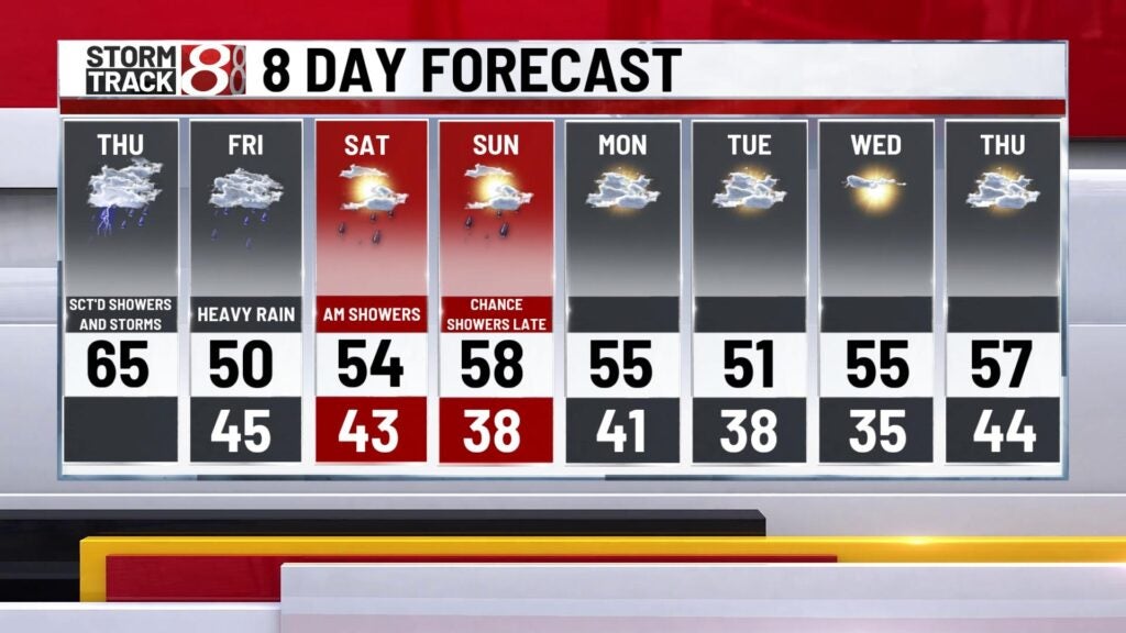
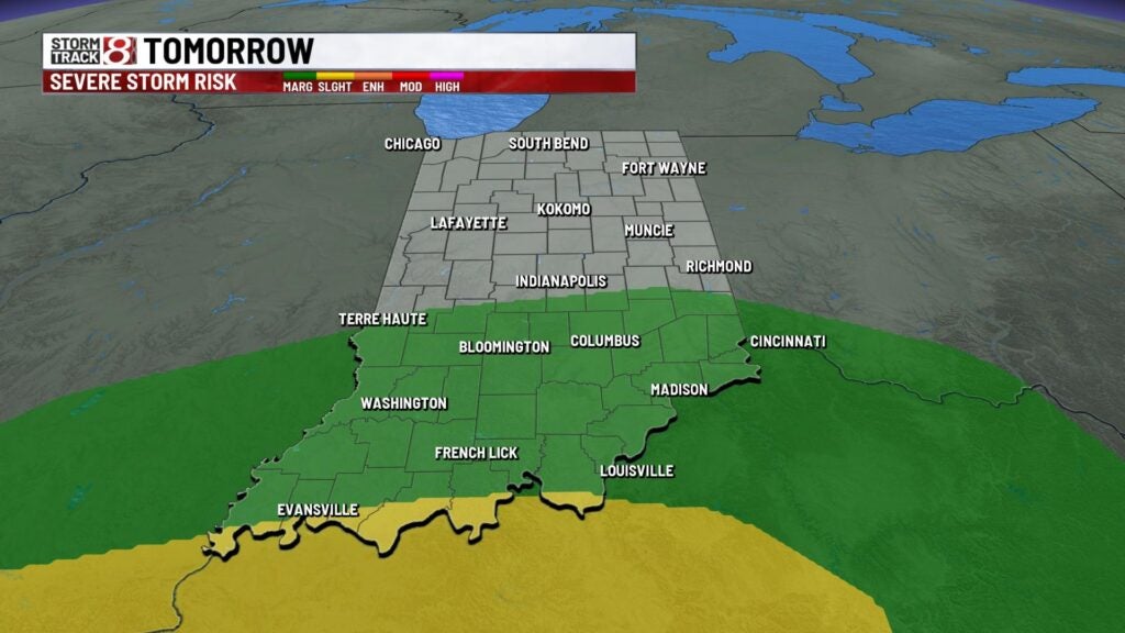
Soaking wet end to the week
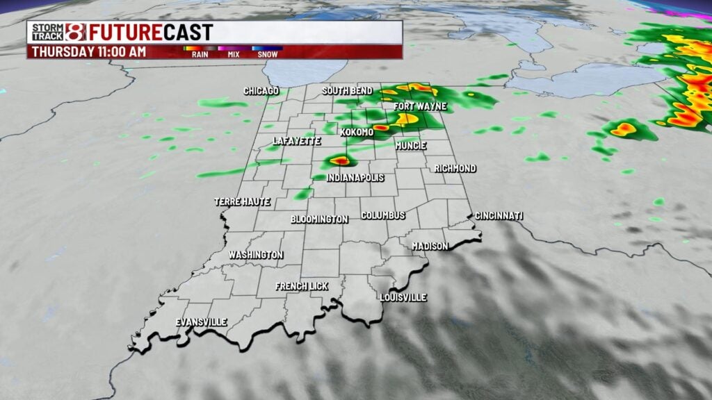
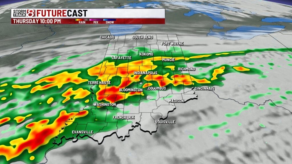
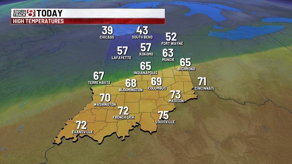
A few light showers around this morning making for a damp start to the day. Temperatures are starting off warm with most spot in the lower 60s. Highs today will warm to the mid 60s with scattered showers and few rumbles of thunder through the afternoon. A few stronger storms could pop this evening with more widespread heavy rain possible through the evening making it the first of several round of heavy rain. Lows will fall to the lower 40s through the overnight. We’ll have a Flood Watch go into effect late tonight through early Saturday morning.

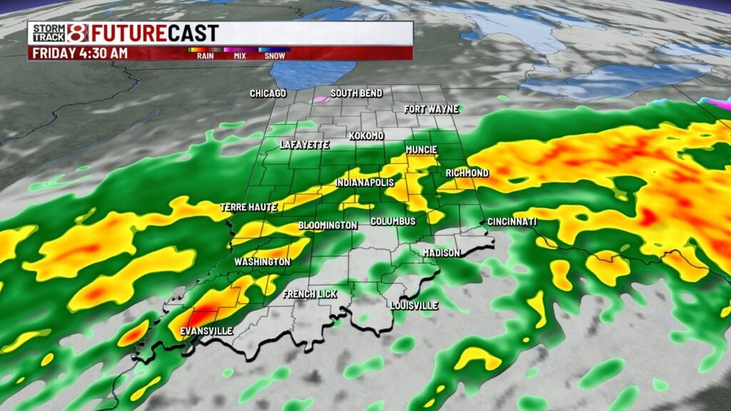


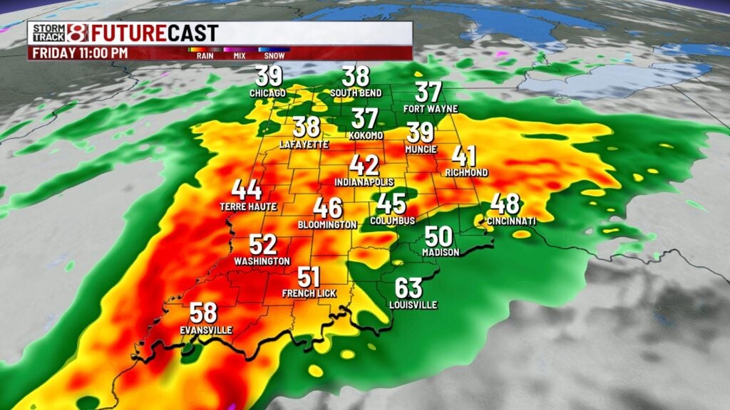
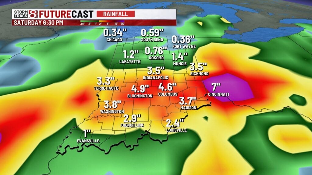
Friday morning we’ll have a few lingering heavy shower then a break mid afternoon. Our second round of heavy rain arrives on Friday evening and will linger through early Saturday morning. By the end of the event we could see 2″-4″ of rain from the city and points south. Highs will cool to the lower 50s.

This weekend will start off damp but we should salvage the afternoon with highs wraming to the mid 50s. Sunday will be mainly dry with highs in the upper 50s to near 60° with showers arriving late. Early next week we’re dry with highs holding steady in the lower to mid 50s.