Severe storms pass through southern half of Indiana
INDIANAPOLIS (WISH) — The National Weather Service has issued a severe thunderstorm watch until 3 a.m. Eastern time Friday for counties southwest of the Indianapolis metropolitan area.
Primary threats are a couple of possible tornadoes; isolated hail up to ping-pong ball-sized possible; and scattered gusts up to 70 mph. Counties in the watch area are Clay, Crawford, Daviess, Dubois, Gibson, Greene, Knox, Lawrence, Martin, Perry, Pike, Posey, Spencer, Sullivan, Vanderburgh, Vigo and Warwick. The watch also extends into southeastern Missouri, southern Illinois and western Kentucky.
— From News 8’s Gregg Montgomery
This is breaking news. Below is the previously posted weather blog. Video with this story is from the 5 p.m. newscast.
Expecting storms Thursday night; colder air returns going into the weekend
INDIANAPOLIS (WISH) — We have a had a quiet and nice Thursday so far, but that will change for tonight with showers and storms expected. We will also watch for the potential of severe weather tonight.
Then, colder air greets our presence heading into this weekend.
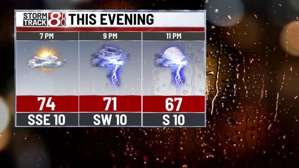
Thursday night: A line of showers and storms will roll through the state tonight.
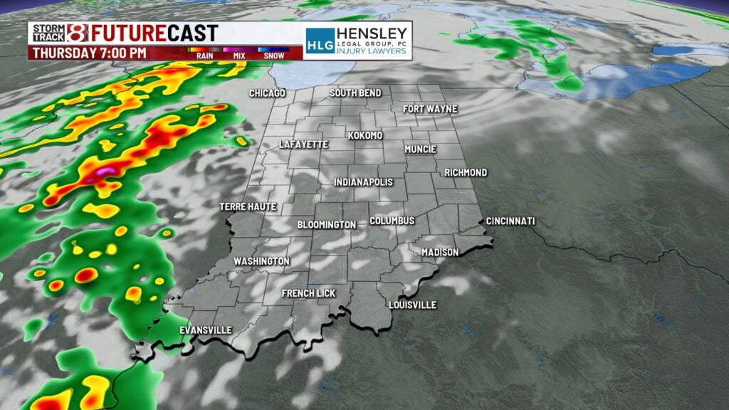
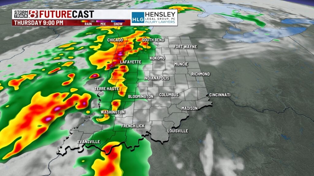
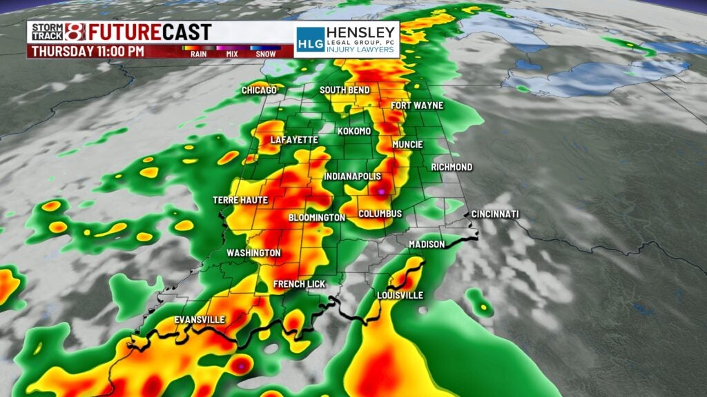

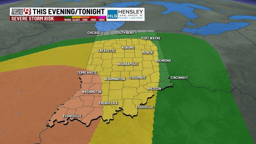
There is the threat for severe storms from mainly 8 PM – 2 AM as there is a Slight Risk (level 2/5) across much of Indiana. There is an Enhanced Risk of severe weather in southwestern Indiana. Damaging winds are the main concern, but large hail and isolated tornadoes are also possible. Localized flooding may become a concern with heavy rain rates expected.
Lows will drop into the upper 40s to low 50s. It will also be breezy tonight with wind gusts over 25 MPH at times.

Friday: A few showers may linger around before daybreak. Then, we decrease cloud cover and work in a colder day due to a northerly breeze. Highs will struggle to get into the 60s in some spots.


Saturday: The cooldown continues into this weekend. Breezy winds out of the north will stick around for the day under partly cloudy skies. Highs will only top out in the mid to upper 50s.

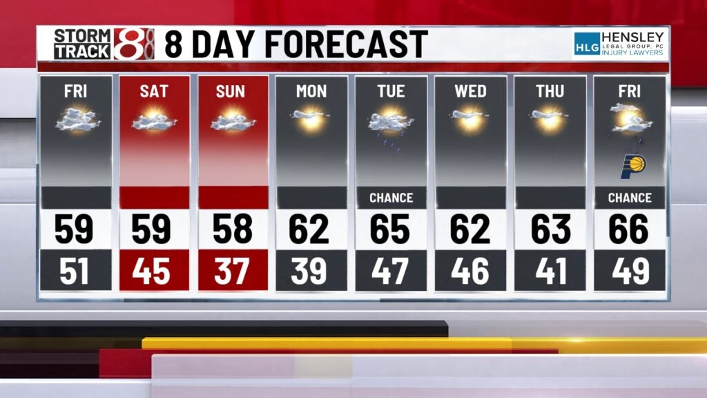
8-Day Forecast: Temperatures stay below normal through Sunday with highs in the mid 60s. We’ll rebound back into the 60s Monday before additional rain chances slide in going into Tuesday. Highs will stay within the low to mid 60s through midweek next week.