Windy Wednesday with storm chances
INDIANAPOLIS (WISH) — Windy day today with a few spotty showers and storms. A better chance of more storms late Thursday.
TODAY: A cold front is going to move through the state today. A few spotty showers and thunderstorms may pop up around 11 a.m. through about 3 p.m. Some thunderstorms may be on the stronger side. Some gusty winds and heavy rainfall is possible.

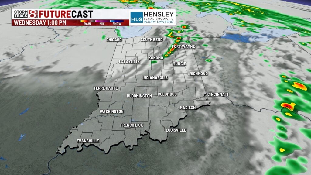
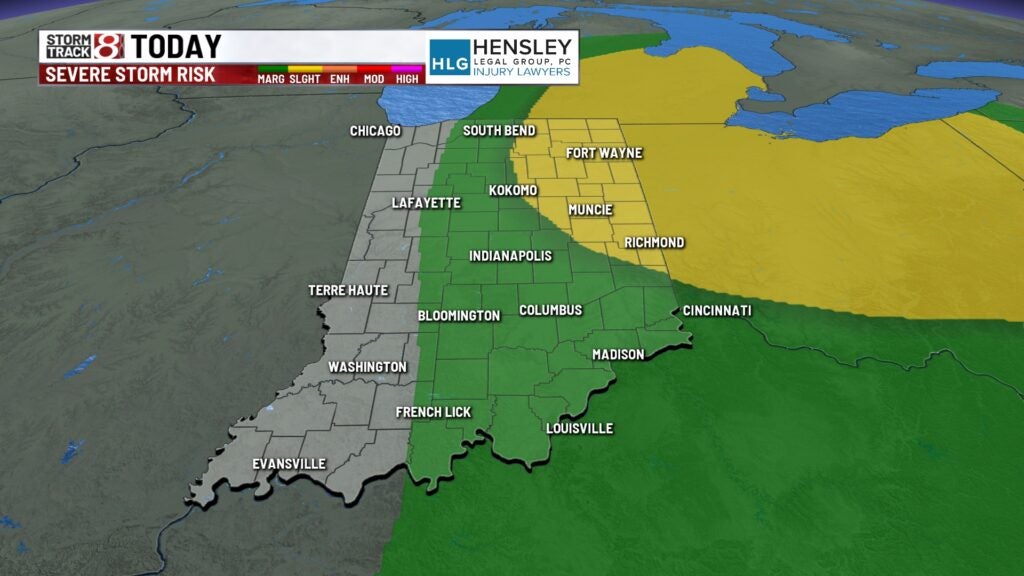
A slight risk which is a level 2 out of a level 5 is in place for northeastern Indiana. It looks like there is a small chance we may see an isolated shower for the Indianapolis Indians game today.
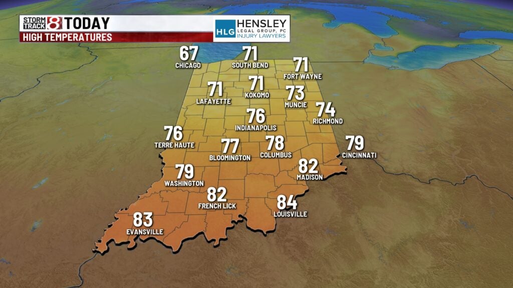
Temperatures climb into the 70s later today. Winds will be high today and may gust 30 to 35 miles per hour.

MORE STORM CHANCES
Much of the day on Thursday will be dry. However later in the evening we have showers and thunderstorms popping up. Some of these storms may be on the stronger side with all severe weather modes in play.
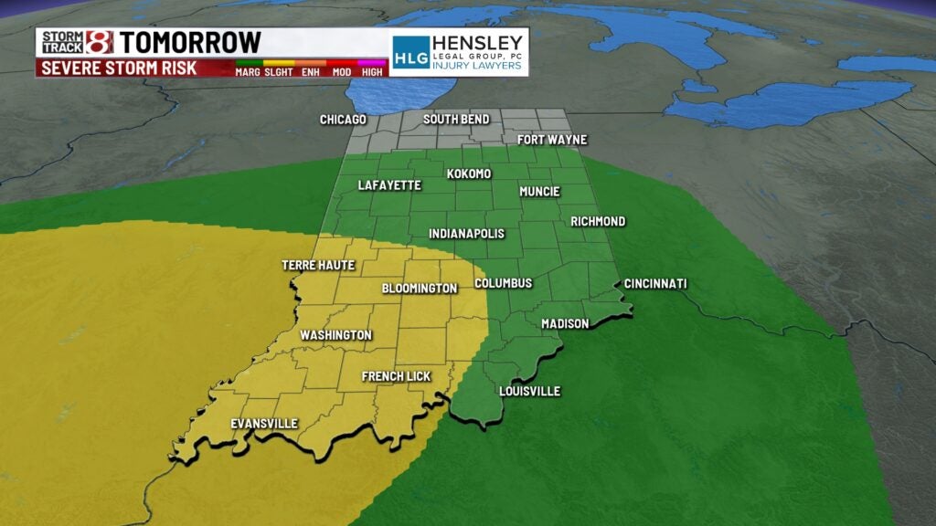
There’s a slight risk across south and western Indiana. Gusty winds, heavy rainfall, hail and even an isolated tornado is possible. Best chance of seeing these storms is from 6pm to around midnight.
Much of Thursday will be dry with some sunshine and highs in the 70s. Winds won’t be as gusty as Wednesday.
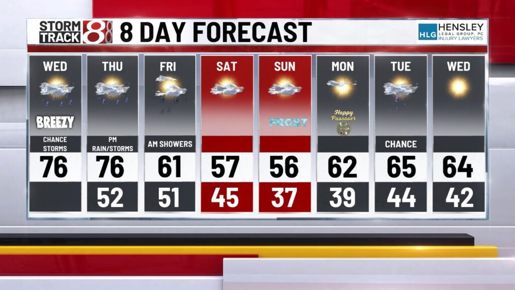
FRIDAY: A few morning showers are possible early on Friday. Otherwise dry for the rest of the day but cooler. Highs stay into the lower 60s.
This weekend looks cooler and dry. Highs stay into the 50s for both Saturday and Sunday. It may be really chilly early Sunday morning. Frosty conditions are possible with temperatures falling into the 30s.
60s return next week with some dry days.