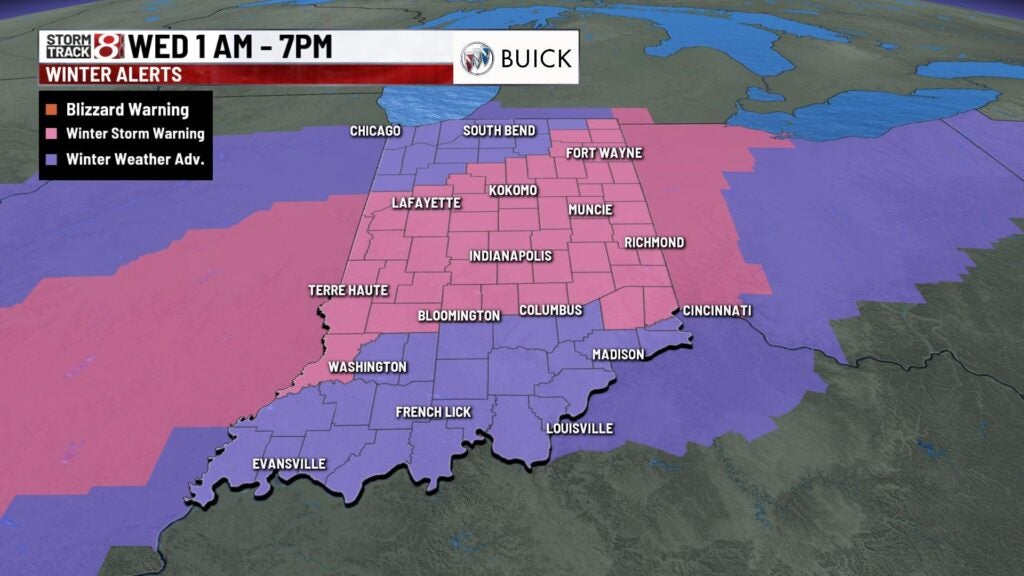
Winter storm warning to begin early Jan. 25, 2023
Winter storm warnings are set to be in effect from 1 a.m. to 7 p.m. Wednesday.
- Check the Storm Track 8 interactive radar
- Check closings and delays
- Tips for driving in winter weather
- 60 Indy Snow Force drivers hitting the streets ahead of winter storm
- Indiana’s travel advisory map
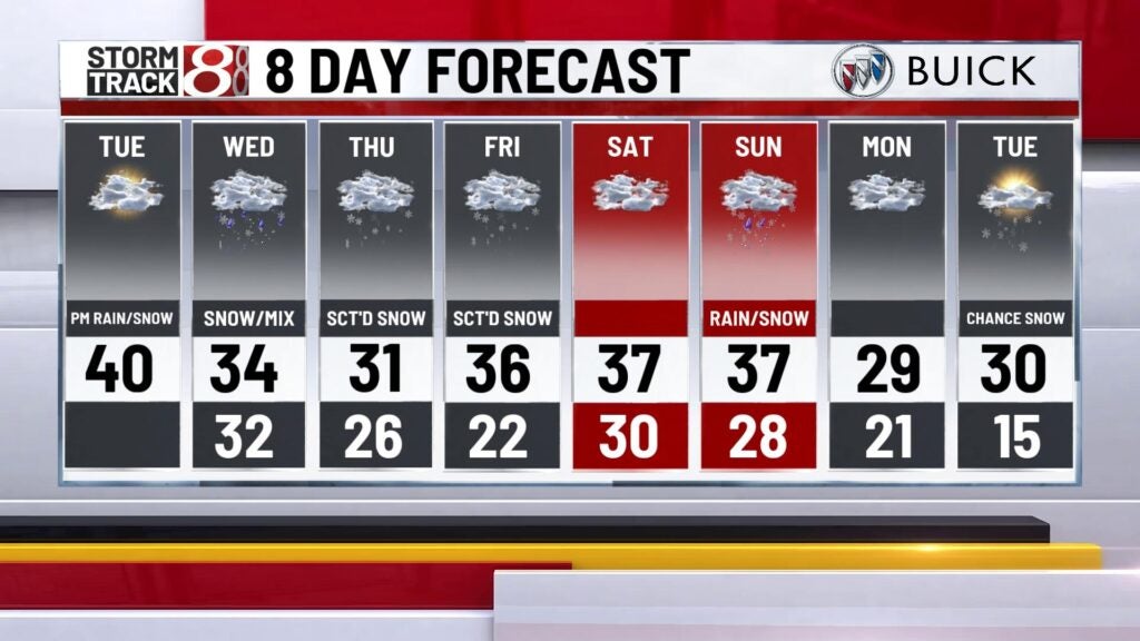
Tuesday will be quiet before the winter weather arrives with highs in the lower 40s with a mix of sun and clouds.


Tuesday night through Wednesday morning:
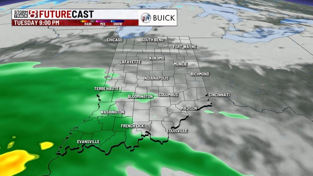
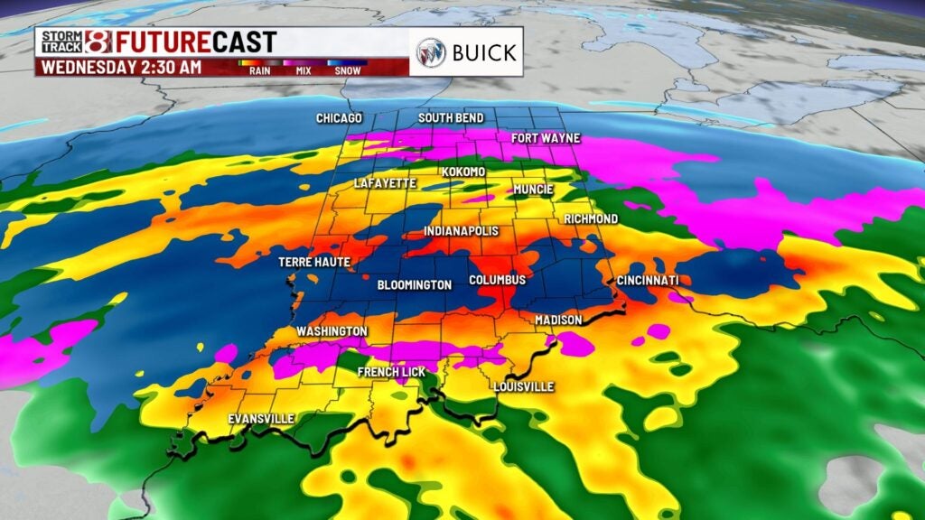
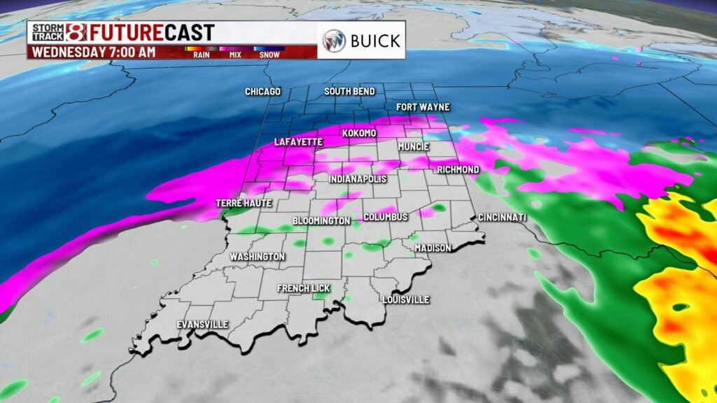
Our next potent winter system arrive late Tuesday night starting out briefly as rain. Rain will eventually transition to snow as we get deeper into the overnight hours and should be heavy at times. Snow will be around from 2-7 a.m. Wednesday with heavy bands setting up for the morning. We’ll already have a few inches on the ground for the morning commute making for some very tricky travel for the morning drive. By midmorning, we could start to see some mixing but should begin to tapper off late morning and early afternoon. By the end of the snow event, we could from 4-8 inches of snow while areas north and slightly south will get from 1-4 inches. Winds will also be gusty at times with gusts around 25-30 mph. Highs will top out in the mid 30s.


On Wednesday night, we’ll see a few light snow showers or a light mix of snow and rain with lows falling to the mid 20s. Winterlike weather will continue through the end of the week with highs in the lower to mid 30s and a few stray snow showers through Friday. This weekend looks seasonal with highs in the upper 30s with a mix of sun and clouds Saturday. On Sunday, a light mix with freezing rain is possible with highs in the upper 30s. It will become cooler through early next week with highs in the upper 20s to lower 30s with snow chances Tuesday.