


Winter storm warning for much of central Indiana
INDIANAPOLIS (WISH) — Cloudy conditions Sunday will give way to two waves of snow heading our way over the 24-36 hours.
Sunday:
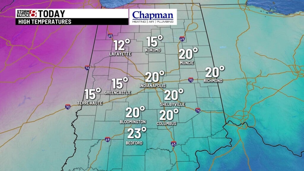
Much of the day will be cloudy and cold, with on and off flurries throughout the day. Highs top out in the upper teens and lower 20s.
Sunday night:
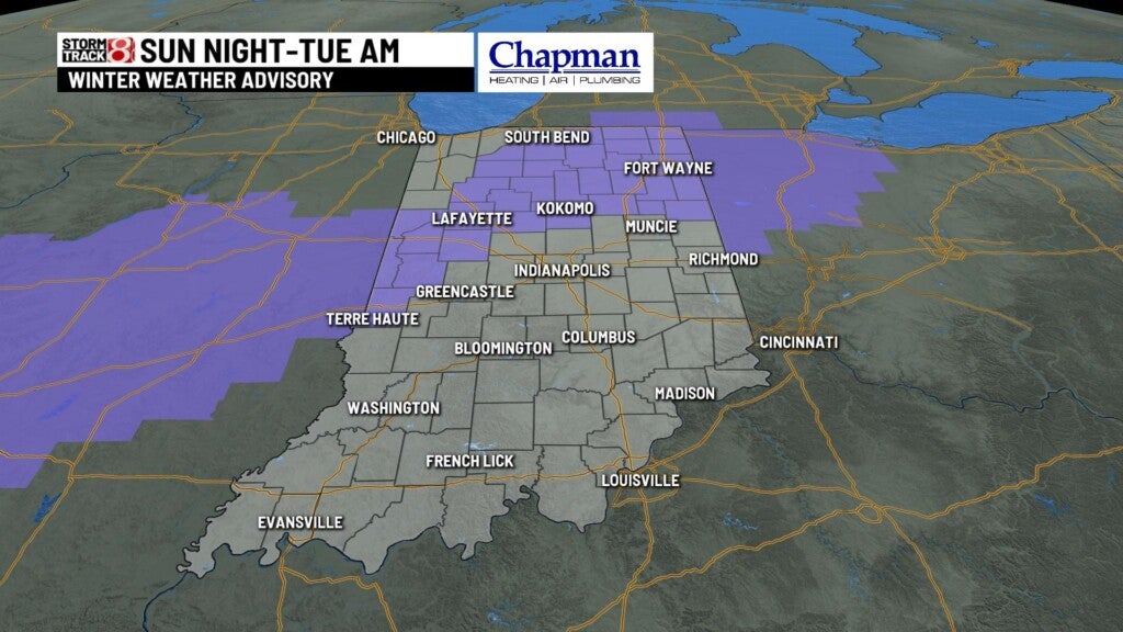
Winter storm warning will go into effect overnight for much of central and southern Indiana. A Winter Weather Advisory is in place for northern counties of central Indiana.

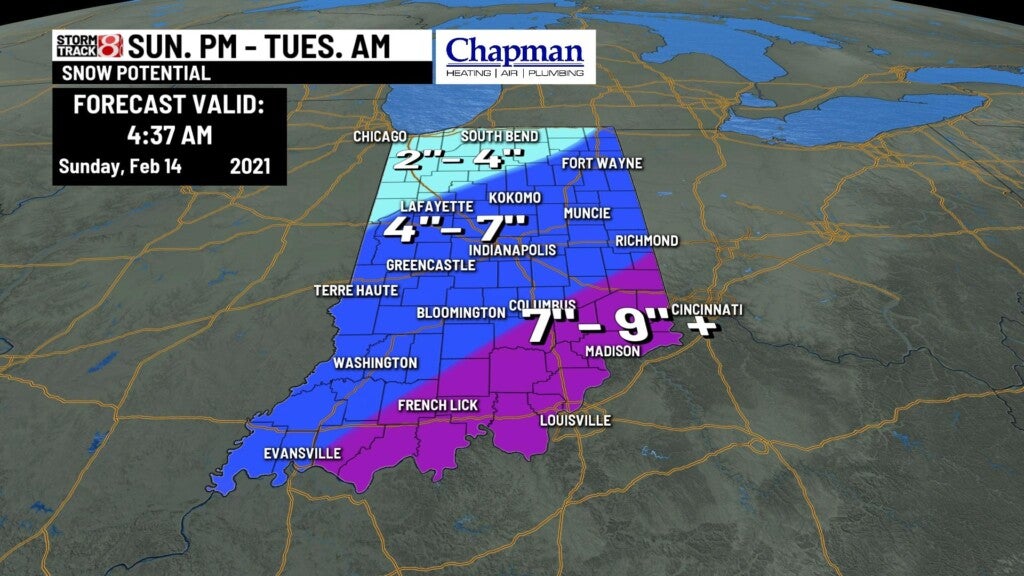
Winter storm closes in central Indiana, bringing the first of two waves of snow to the area just before Midnight. Expect steady snow showers through much of the overnight. Accumulations should be around 1-2″, with some areas hitting up to 3″ just in time for the morning commute.


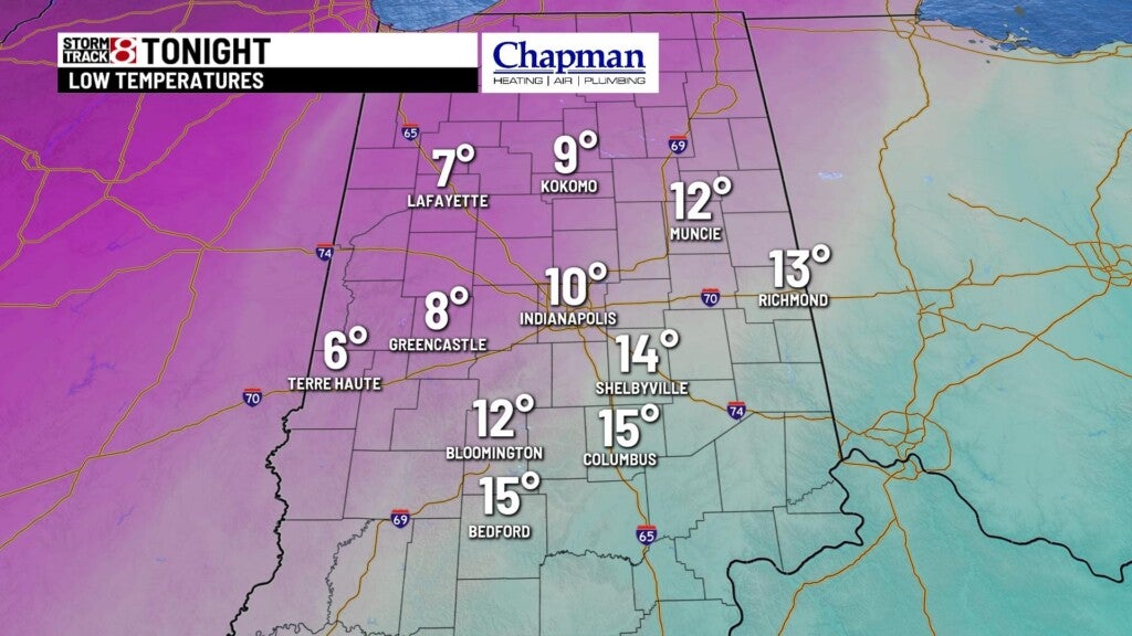
Overnight lows fall to the middle teens.
Monday:
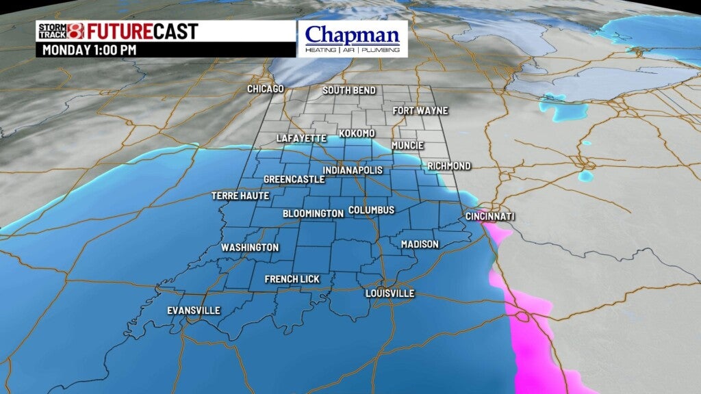
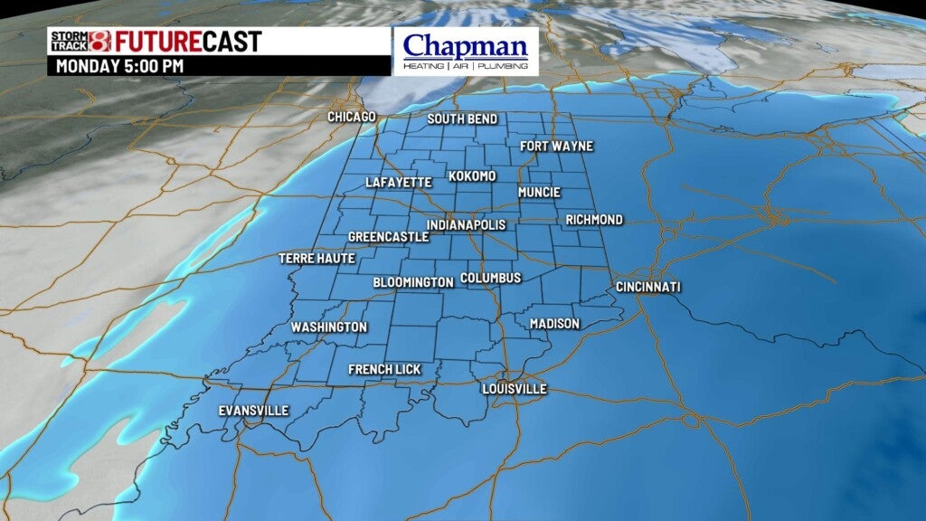
The first round of snow will taper off by early to mid-morning. We’ll likely have a few hours of quiet time before our second wave, which should have more of an impact, arrives by early afternoon. Expect steady, and at times heavy snow through the afternoon and early evening hours, before snow gradually tapers off by late night.

An additional 3-5″+ can be expected across central and southern Indiana with the second wave. This puts our total for the event at around 4-7″ across most of central Indiana, and up to 6-9″+ in southeastern portions of our state.

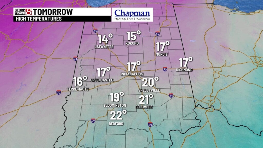
Highs on Monday top out in the mid-teens.

8 day forecast:
With the exception of a few light snow showers Tuesday morning, we’ll have a couple of days of quiet weather for Tuesday afternoon into Wednesday. Another potent system moves into the Midwest Thursday, bringing another chance for accumulating snow and possible mixed precipitation. We’ll remain cold through the end of the week, with the possibility of getting at or above freezing for the first time in over a week by the end of next weekend.
