Winter storm watch in effect Tuesday night into Wednesday
WEATHER ALERT: A winter storm watch will go into effect at 1 a.m. Wednesday through 4 p.m. Wednesday. At some point in the next 24 hours, the watch will become either an advisory or a warning.
MONDAY NIGHT: Prepare for another cold night as temperatures fall to the 20s under mostly cloudy skies. Low 27.

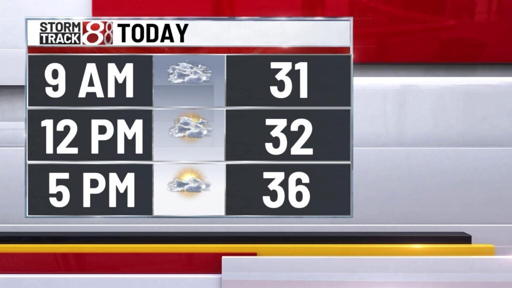

TUESDAY: Enjoy a dry but cold start to the day with temperatures in the 20s. Clouds and precipitation chances will increase throughout the day. Above normal temperatures in the upper 30s to low 40s are expected. Showers will arrive late Tuesday evening. High 40.
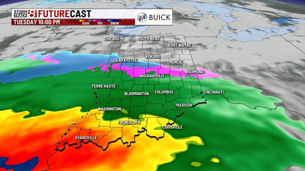
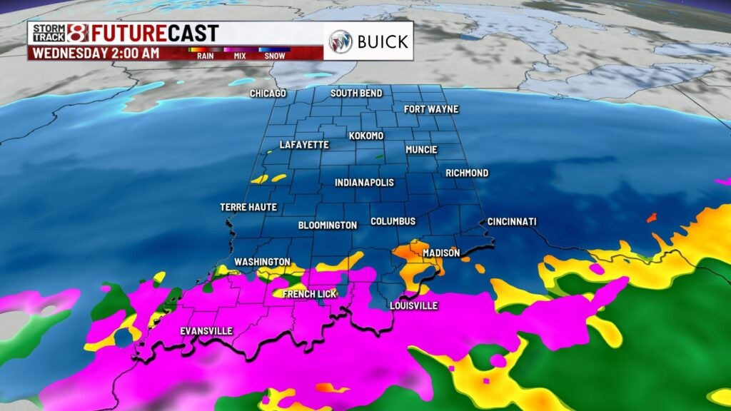
TUESDAY NIGHT: We’ll see windy and mild conditions for the Tuesday evening commute. Temperatures will slowly fall from the 40s to the 30s as rain arrives. Rain will transition to snow before sunrise Wedmesday. Low 32.
Temperatures will hold steady in the mid to upper 30s as precipitation arrives Tuesday evening. Expect the onset of precipitation to be rain Tuesday night.

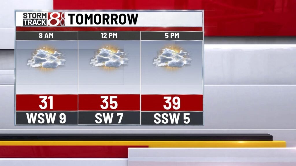
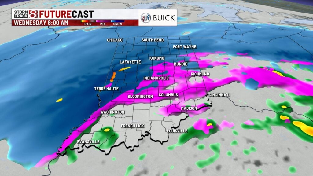
WEDNESDAY: Wednesday will be an active day of weather as we’ll start the day with a wintry mix, with slick roads and difficult driving conditions starting Wednesday morning. Heavy snow showers will arrive during the Wednesday morning commute. Several inches of snow remain possible before the lunch hour. Wednesday will quickly become snow-covered, windy and colder. High 34.
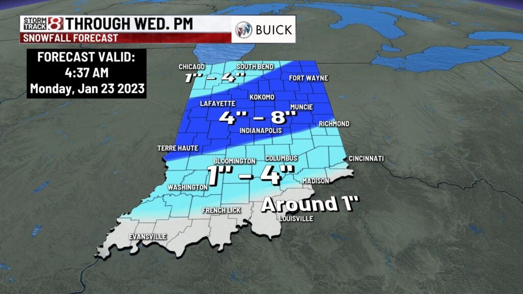
As colder air sinks into the state Tuesday overnight into Wednesday, rain will transition to snow. Several inches of snow will be possible before the lunch hour Wednesday. Expect from 4-8 inches for central and northern Indiana, and lower amounts south.

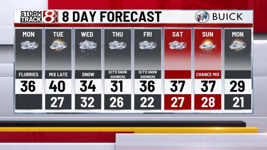
8-DAY FORECAST: Snow showers will move out before sunset Wednesday, Colder air will sink into the state Wednesday night expect overnight lows in the 20. We’ll end the week with chilly conditions expect highs in the 30s throughout the weekend. Scattered light snow showers are possible daily through Sunday.